
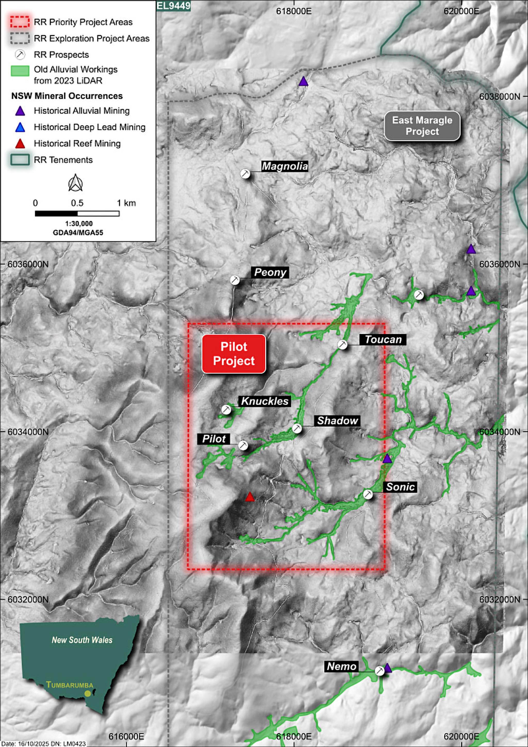
Pilot Project
The Pilot Project is the Company’s flagship project, covering 6.96km2 (2.4km x 2.9km) within EL9449, located southeast of the town of Tumbarumba, NSW. The project encompasses five key prospects: Pilot, Knuckles, Shadow, Toucan, and Sonic.
Key highlights
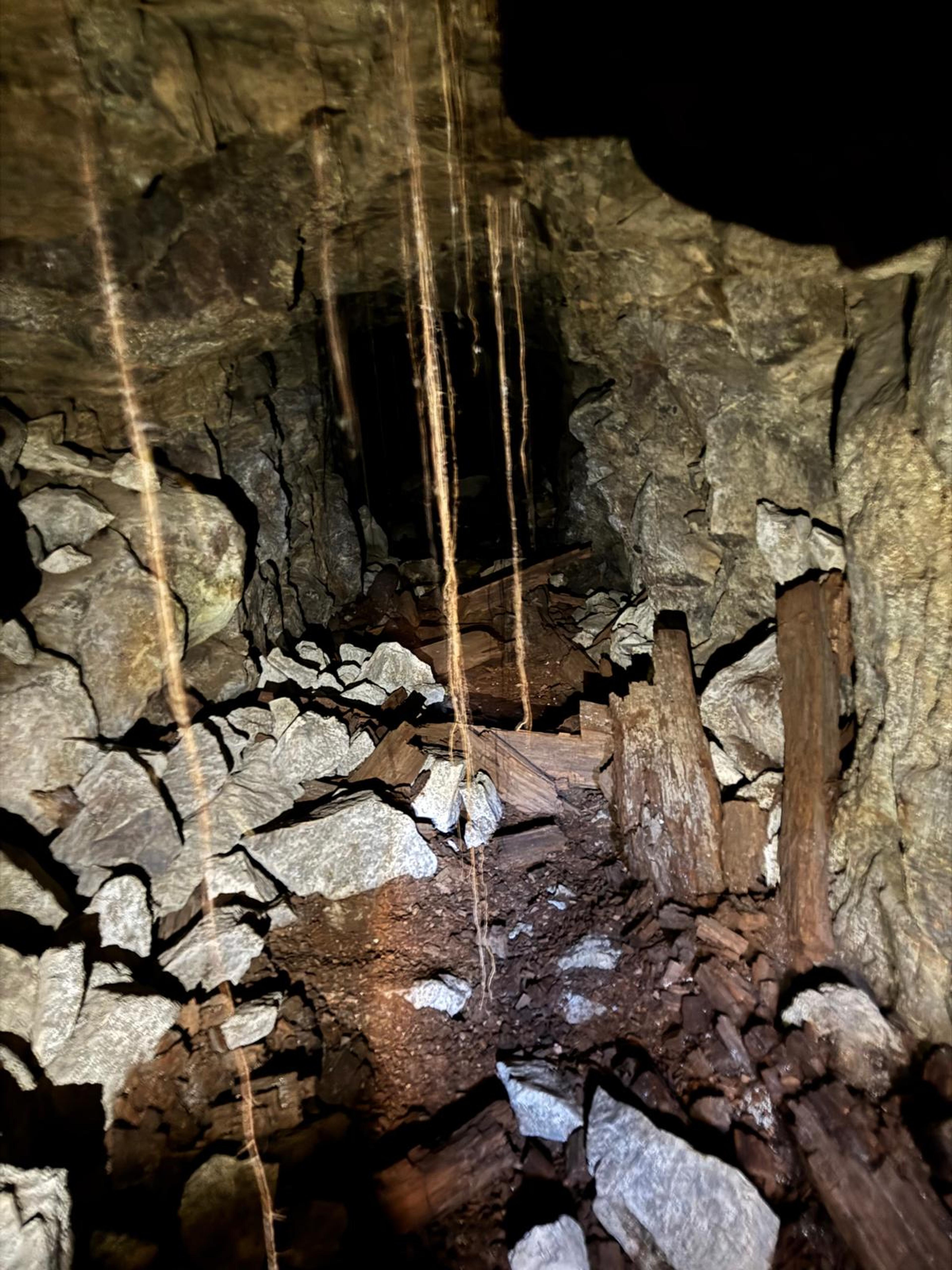
- Historical Production: Historical reporting records confirm high grade gold of 38 g/t between 1876 to 1881 from the Pilot underground operations. Records prior to this time are missing.
- Limited Modern Exploration: Despite the scale of historical workings, the area has seen minimal exploration for epithermal and porphyry-style gold-copper systems, with no modern exploration drilling completed to date.
- LiDAR Interpretation: Desktop studies and LiDAR analysis have identified over 1,700 possible mining related workingsincluding widespread sluicing leading to underground shafts, indicating a broader extent of historical activity than previously recorded. This work has also enabled identification of mineralisation trends.
- Surface Geochemistry: Company-led rock chip sampling has returned anomalous gold values ranging from 0.1 g/t Au to 56.6 g/t Au. Surface mapping has confirmed the presence of pyrite-dominant sulphides across porphyry, rhyolite and altered granite lithologies, supported by petrological analysis.
- Geophysical Targets: A recent airborne modern magnetic (mMT) geophysical survey has delineated a 6km strike length of conductors and 9 geophysical anomalies, many of which are coincident with verified historical gold workings and surface occurrences in the Pilot Project area.
- Drill-Ready Status: Permits are in place to commence a Phase 1 drilling program, targeting mineralisation beneath significant underground workings.
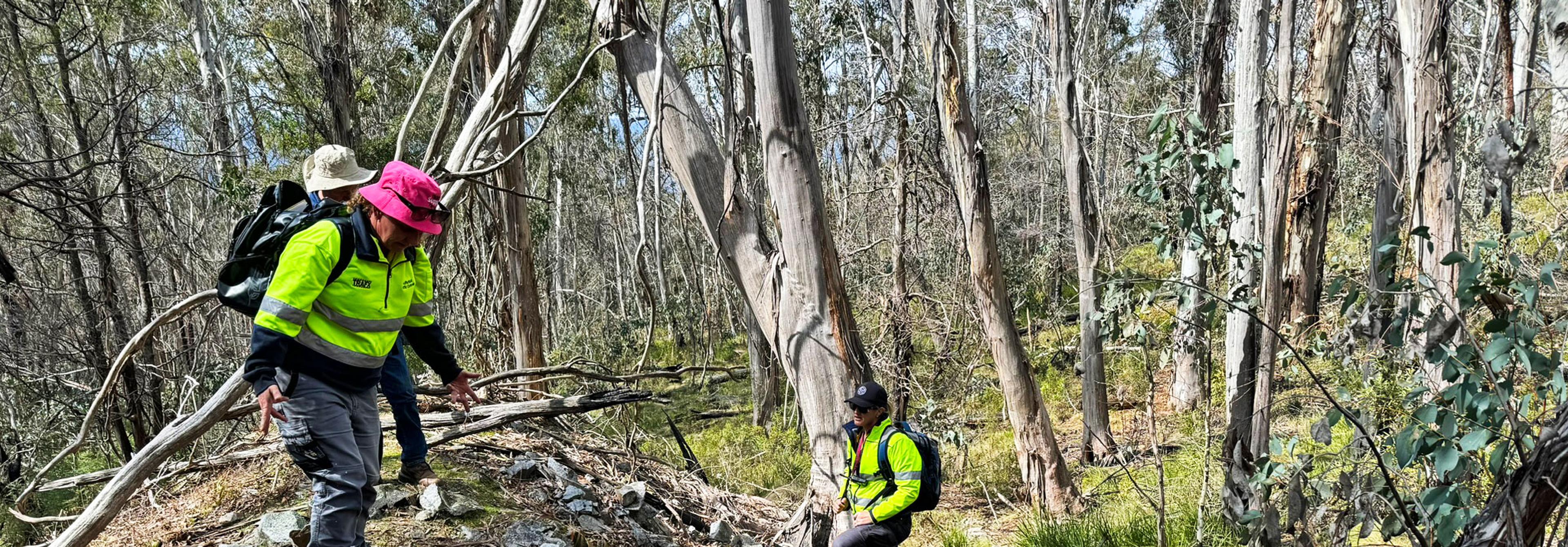
The Pilot Project was identified by the Company based on evaluation of LiDAR acquired topography and radiometric geophysical data, and by on-ground mapping and sampling by the Company’s geologists during 2024.
Reconnaissance work completed by the Company has identified multiple intrusive and extrusive phases across the tenement, including flow banded and porphyritic rhyolites, altered dolerites, sediments and porphyry and granitite units.
In 2024 and 2025, field activities included surface sampling for geochemical analysis and petrology sampling for rock characterisation. This work also provided visual confirmation of alluvial workings and shafts that were identified through desktop studies and analysis of LiDAR data. Rock chip data collected by the Company has returned anomalous values ranging from 0.1 g/t and up to 56.6 g/t Au.
For more information and latest results, please view our ASX Announcements.